[Courtesy of Hanwha Systems]
Synthetic-aperture radar (SAR) is a form of radar used to create two-dimensional images or three-dimensional reconstructions of objects, such as landscapes. The image processing of all-weather sensor SARs is gaining importance due to the endless use of high-resolution images, wide-area images, change detection, and 3D images for disaster monitoring and damage analysis.
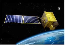
Hanwha Systems said its technology would be combined with the technology of SaTRec, a satellite technology research center of the Korea Advanced Institute of Science & Technology (KAIST), to develop high-resolution ultra-small SAR satellites. It is part of a government project to operate ultra-small SAR satellites that can be used to establish a military reconnaissance satellite system and collect all-weather image information on the Korean Peninsula and surrounding areas.
SAR creates a ground topographic map by sequentially shooting radar waves from the air and synthesizing the minute time differences reflected by radar waves on the curved surface on a first-come, first-served basis.
Hanwha Systems' ultra-small SAR satellite is a thin rectangular type integrated with SAR payload and solar panels and a satellite body. Many SAR satellites can be loaded on a single projectile to maximize storage efficiency and reduce launch costs. "The ultra-small SAR satellite is receiving great attention as it is recognized for its very high value as a surveillance and reconnaissance asset," Hanwha Systems CEO Eoh Sung-chul said in a statement on October 24.
Copyright ⓒ Aju Press All rights reserved.


