SEOUL, August 04 (AJP) - Japan's annual defense white paper describes South Korea as an important neighbor and a partner it should work with on shared international challenges. The same document, published Tuesday, again calls Dokdo, an islet located in the East Sea, Japanese territory.
The government lodged a formal protest and demanded immediate withdrawal of the claim, which has appeared in the white paper every year since 2005, now 22 years running.
Dokdo consists of two main islets, Dongdo and Seodo, and 89 smaller rocks, covering roughly 187,554 square meters in the East Sea. It sits 87.4 kilometers (54.3 miles) from Ulleungdo and 157.5 kilometers from Japan's Oki Islands. On a clear day, it is visible from Ulleungdo. It is not visible from Oki.
The islets carry a South Korean address, Dokdo-ri, Ulleung-eup, Ulleung County, North Gyeongsang Province. A police detachment has been stationed there since 1954, when a lighthouse also began operating, and a small number of civilians are registered as residents.
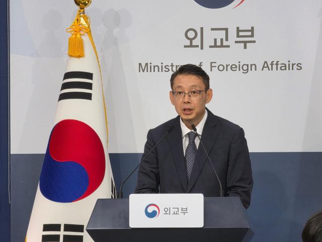
The Foreign Ministry issued a spokesperson's commentary saying the government strongly protests the repetition of an unjust territorial claim over what it called historically, geographically and legally South Korean territory.
"The government makes clear once again that Japan's unjust claim has no effect whatsoever on our sovereignty over Dokdo," foreign ministry spokesperson park Doo-soon said. He added that South Korea will respond firmly to any Japanese provocation regarding Dokdo.
Japan's cabinet approved the 2026 white paper earlier the same day. The text says territorial issues remain unresolved over what it calls Japan's inherent territory in the Northern Territories, meaning the four southernmost Kuril Islands held by Russia, and Takeshima, the Japanese name for Dokdo.
The wording matched previous editions. So did the maps. A chart of the security environment around Japan again marked the islets as a territorial dispute, a surveillance map drew the surrounding waters as Japanese territorial sea, and a diagram explaining South Korea's air defense identification zone labeled the islets Takeshima.
The partner language has now run for three years. Material on South Korea took up less space than last year.
This was the first defense white paper issued under Prime Minister Takaichi Sanae. The Dokdo passage survived the change of government intact.
Japan's Foreign Ministry made the same claim in its diplomatic bluebook on April 10, prompting the ministry to summon Matsuo Hirotaka, the Japanese Embassy's minister-counselor, to hear a protest in person. In July last year, deputy chief of mission Iseki Yoshiyasu was called in over the previous defense white paper.
That difference in sight lines between Ulleungdo and Oki runs through the historical record.
The earliest reference appears in the Samguk Sagi, the 12th-century history of the Three Kingdoms, which records that the Silla general Isabu subjugated the island polity of Usan-guk in 512. Usan-guk was centered on Ulleungdo and its territory included the smaller islets to the southeast.
The Sejong Sillok Jiriji, a geographical survey completed in 1454, states that Usan and Mureung lie in the sea due east of Uljin County, and that the two are close enough for one to be seen from the other when the weather is clear. Mureung is Ulleungdo. Usan is Dokdo. Only Dokdo satisfies the visibility condition.
The Sinjeung Dongguk Yeoji Seungnam, an expanded national gazetteer published in 1531, repeated the description and included Usando on its maps.
Japan's own records point in the same direction. In 1877, the Meiji government's Grand Council of State, the Dajokan, responded to an inquiry from the Home Ministry about whether Ulleungdo and one other island should be entered into Shimane Prefecture's land registry. The directive instructed officials to bear in mind that Ulleungdo and the other island had nothing to do with Japan.
The Dajokan was the highest organ of state at the time, with authority over legislation, administration and the judiciary. Its ruling on a question of territorial extent bound the entire government, not just the ministry that asked. An attached map, the Gijukdo Yakdo, identifies the second island as Dokdo.
That directive followed decades of earlier settlement. After the Joseon fisherman An Yong-bok crossed to Ulleungdo and was seized by Japanese fishermen in 1693, the two governments spent three years arguing over access. In 1696 the Tokugawa shogunate banned Japanese vessels from sailing to Ulleungdo, closing the dispute.
In October 1900, the Korean Empire issued Imperial Decree No. 41, elevating Ulleungdo to Uldo County and defining the county magistrate's jurisdiction as Ulleungdo, Jukdo and Seokdo. Seokdo means rocky island, a rendering of the local name for Dokdo. The decree was promulgated in the official gazette on Oct. 27, five years before Japan acted.
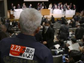
Japan's incorporation came on Feb. 22, 1905, through Shimane Prefecture Public Notice No. 40. It was issued during the Russo-Japanese War, was never published in Japan's national gazette, and was not communicated to the Korean government.
By then Korea's capacity to object had already been cut away. The Japan-Korea Protocol of February 1904 permitted Japanese forces to use Korean territory for military purposes, and the first Japan-Korea Agreement of August 1904 installed Japanese advisers inside the Korean government. Japan built a naval watchtower on the islets in 1905 to track the Russian fleet.
Uldo County magistrate Sim Heung-taek learned of the incorporation only in March 1906, from a Shimane survey party that landed on Ulleungdo. He reported to his superiors that an island belonging to his county had been declared Japanese. The State Council responded through Directive No. 3 that the claim was entirely without foundation and ordered a further investigation.
After Japan's defeat in World War II, the Allied powers took the islets out of Japanese hands. Supreme Commander for the Allied Powers Instruction No. 677, issued on Jan. 29, 1946, suspended Japanese administrative authority over Ulleungdo, Dokdo and Jeju Island. A follow-up instruction that June placed Dokdo outside the area open to Japanese fishing.
Japan rests its modern case on the 1951 Treaty of San Francisco. Article 2 names Jeju, Geomundo and Ulleungdo among the territories Japan renounced, and does not name Dokdo. Tokyo reads that omission as recognition of Japanese title.
Seoul reads the list as illustrative rather than exhaustive, covering three of the roughly 3,000 islands surrounding the peninsula, and argues that the treaty did not reverse SCAPIN 677 or the Cairo Declaration of 1943, which committed the Allies to stripping Japan of territory taken by violence and greed.
Japan also argues that its sovereignty was established in the 17th century, when the Oya and Murakawa merchant houses of Yonago received shogunal licenses to sail to Ulleungdo and used Dokdo as a waypoint. South Korea points out that the same shogunate banned those voyages in 1696, and that a navigation license is not a claim of title.
South Korea declared sovereignty over the adjacent seas including Dokdo in January 1952, in what became known as the Peace Line. Japan protested that month. In 1954, Tokyo proposed taking the question to the International Court of Justice, and Seoul refused. Japan renewed the proposal in 1962 and again in 2012, and was refused both times.
The South Korean position has not moved since. There is no territorial dispute to adjudicate, because the islets are South Korean territory under effective administration.

Copyright ⓒ Aju Press All rights reserved.